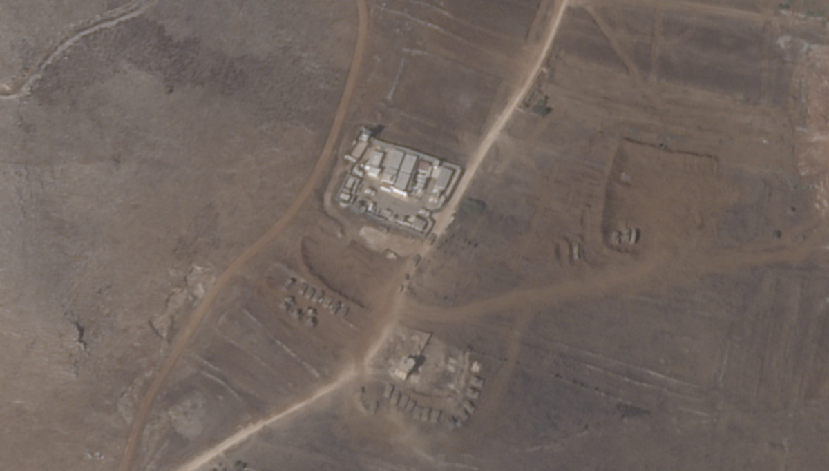
New SkySat imagery from Planet Labs PBC shows Israeli military vehicles outside a United Nations Interim Force in Lebanon (UNIFIL) base in the southern part of the country. The Israel Defense Forces (IDF) are near a post where Irish peacekeeping troops are stationed.
The images, shared by Planet Labs, were taken on October 5, days after Israel announced it was officially launching ground operations in the region to combat Hezbollah.
Caption: Planet Labs PBC satellite images shows changes to the landscape around the UNIFIL base between September 29 and October 5.
Compared with SkySat imagery taken less than a week earlier on September 29, new military activity is visible in the area of the Irish UNIFIL base located at 33.096235, 35.458235. The base is officially known as “UNP 6-52”. Images from October 5 show at least 30 military vehicles that appear to belong to the IDF. New roads are visible, and nearby orchards have been cleared, something that has also happened during operations in Gaza.
Ireland’s Raidió Teilifís Éireann (RTÉ) reported the presence of an IDF position set up near UNP 6-52 on October 6. The Irish public broadcaster revealed that the IDF were firing from the location on October 5 and had asked for the outposts to be “vacated”.
UNIFIL released a statement on October 6 saying it was “deeply concerned by recent activities by the IDF immediately adjacent to the Mission’s position 6-52.” It stressed that it was “unacceptable to compromise the safety of UN peacekeepers”.
UNIFIL’s mandate is not to enforce but to monitor peace in the area. It also assists the army of Lebanon in keeping the area free of any armed personnel.
The IDF did not respond to a request for comment before publication.
The Israeli military has been conducting ground operations “because of how Hezbollah has built its network of attack infrastructure,” IDF spokesperson Lieutenant Colonel Peter Lerner told RTÉ.
“For the safety of the UN peacekeepers, we asked them to move out of those locations,” he said.
Images shared on X, formerly known as Twitter, also show the presence of IDF vehicles near the UNP 6-52 base. Similar images were also shared by the Irish Daily Mirror on October 6.
Other Sites Damaged
The UNIFIL base wasn’t the only area where the IDF presence was visible in the October 5 imagery. The nearby town of Maroun El Ras was also visibly damaged compared with earlier imagery, with a park known as the “Iran Garden” appearing to be mostly destroyed after it had already been damaged by airstrikes earlier in the year. Newly burned areas and IDF vehicles near new clearings are also visible.
Caption: Planet Labs PBC satellite images show changes to the landscape around the UNIFIL base between September 29 and October 5
Planet Labs also released PlanetScope imagery from October 7, which has a lower resolution than SkySat imagery but showed further damage to Maroun El Ras.
The village of Yaroun, which is about 3.5 kilometres from Maroun El Ras, was also heavily damaged in a drone footage clip shared on X. RTÉ’s Mark Coughlan geolocated the footage and noted the village would have been visible from another Irish UNIFIL post, UNP 6-50.
There was no Planet Labs SkySat imagery available for Yaroun, though the PlanetScope imagery from October 7 shows visible damage to the village compared to September 30 imagery.
Caption: Planet Labs PBC satellite images show changes to the landscape around the UNIFIL base between September 30 and October 7
Bellingcat reached out to UNIFIL to ask if it wanted to expand on its existing statements and whether it had received any response from the IDF after stating that it had communicated to them through existing channels.
UNIFIL did not respond before publication.
Bellingcat is a non-profit and the ability to carry out our work is dependent on the kind support of individual donors. If you would like to support our work, you can do so here. You can also subscribe to our Patreon channel here. Subscribe to our Newsletter and follow us on X here and Mastodon here.


